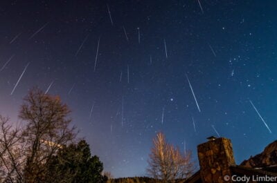
Where to see the Geminid meteor shower in 2023
Latest news 5 minute read
Read articleThe map shows light pollution levels near Yorkshire Air Museum, as indicated by the latest data from the Visible Infrared Imaging Radiometer Suite (VIIRS) instrument aboard the NASA/NOAA satellite.
Our most recent astronomical articles...
Latest news 5 minute read
Read article
Latest news 4 minute read
Read article
Latest news 5 minute read
Read article
Latest news 2 minute read
Read article
Latest news 1 minute read
Read article
Latest news 2 minute read
Read article