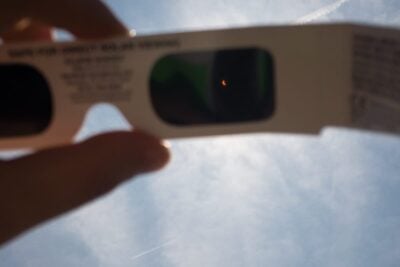
Eclipse glasses for the partial solar eclipse
Latest news 5 minute read
Read articleFind light pollution levels across the UK and the World using our light pollution map. The data is from the Visible Infrared Imaging Radiometer Suite (VIIRS) instrument aboard the NASA/NOAA satellite, as captured in 2024. Note these instruments are not sensitive to white light from LEDs, now commonly used in street lights. Therefore, light pollution levels are expected to be worse than indicated, especially in inhabited areas. In the map, what appears to be light pollution at Northern latitudes is the Aurora Borealis (the Northern Lights).
Our most recent astronomical articles...
Latest news 5 minute read
Read article
Latest news 10 minute read
Read article
Latest news 5 minute read
Read article
Latest news 4 minute read
Read article
Latest news 4 minute read
Read article
Latest news 5 minute read
Read article